

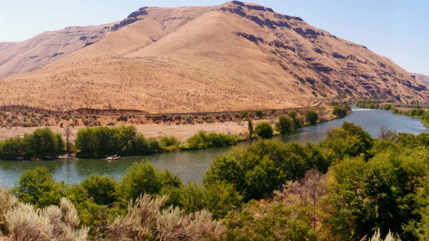
Overview:The Deschutes River begins its journey high in the Cascade Mountains of Oregon at Little Lava Lake and travels through deep rimrock-lined canyons on its 252-mile course north to the Columbia River. The last 100 miles of this path were designated as an Oregon Scenic Waterway in 1970 and a Federal Wild and Scenic River in 1988. The Lower Deschutes River is managed cooperatively by three agencies: Prineville District Bureau of Land Management; the Confederated Tribes of Warm Springs; and Oregon Parks and Recreation Department.
Boater Passes are required year-round, for both day and overnight use, for anyone using a watercraft or any other floating device as a means of transport on the Lower Deschutes River. Access is restricted to a limited number of boaters on some segments during peak use periods. Limited Entry passes can be reserved up to 26 weeks in advance. Learn more about these limits, the four unique
Lower Deschutes River segments and camping guidelines along the Lower Deschutes River.
The Deschutes has a rich cultural history, providing food and water for thousands of years to the Warm Springs and Wasco people moving seasonally through the area. In the 1800s, due to increasing pressure from settlers, many moved to the lands now known as the Warm Springs Reservation, which borders much of the west side of the Lower Deschutes. Members of the Confederated Tribes of Warm Springs retain their fishing rights and can be seen dip net fishing the traditional way, leaning from platforms over the river just below Sherars Falls.
The Deschutes has a unique flow that is fairly uniform compared to other similar rivers. The annual fluctuation between flows is small due to the many nourishing springs that feed the river in the upper reaches, and the effects of the Pelton Reregulation Dam, which delivers a uniform flow for the last 100 miles.
Visitors on the river pass through steep canyons that reveal their volcanic origin in the towering basalt columns lining the rims. The elevation drops from 1,393 feet at Pelton Dam to 160 feet at its confluence with the Columbia River. The average gradient is 13 feet per mile and is relatively constant throughout its length. The most significant drops in gradient are Sherars Falls (River Mile 44), with a vertical drop of 15 feet, and Whitehorse Rapids (River Mile 75), with a gradient of approximately 35-40 feet over one mile.
Many outstanding opportunities draw people to the Lower Deschutes River. Thousands come every year to enjoy world class fishing, exciting whitewater and beautiful scenery. No matter where you are along the Lower Deschutes, you will experience an incredible geologic and cultural history, a diverse community of fish, wildlife and vegetation, and an abundance of recreational opportunities. Whatever you plan to do, if you want to stay overnight, arrive early to get a campsite, especially during summer weekends. Come enjoy a unique opportunity to discover the historic and present day wonders of the Deschutes River canyon!
Class III · Near Warm Springs, OR · Permit required
Snapshot
Important information for this section of river
Quick Links
- Recreation.gov
- Warm Springs Tribal Permit
- Lower Deschutes River Rules/Regulations
- Lower Deschutes Wild & Scenic River Site
- Aquatic Invasive Species Permit
- Boater Pass Release Schedule
- Lower Deschutes Motorboat Schedule
- Oregon State Marine Board
- Oregon Department of Fish and Wildlife
- Oregon Parks and Recreation Department
- Lower Deschutes River Management Site
Create An Alert For This River
Current Availability
The following dates have one or more sites available
| S | M | T | W | T | F | S |
|---|---|---|---|---|---|---|
| S | M | T | W | T | F | S |
|---|---|---|---|---|---|---|
Last checked 27 minutes ago
Water Level
FAQ: What's the current water level for Lower Deschutes River?
4,380 CFS
Adjust the graph period to view water levels over time
Create a free account for water level trends, CFS alerts, and more.
Already have an account?
FAQ: What's the ideal range for this section of river?
3,000 – 8,000 CFS
Rapids
Community-contributed. Conditions change with flow. Scout everything.
No rapids logged yet for this river.
Boat Launches
Community-contributed. Conditions change with flow. Scout everything.
No boat launches logged yet for this river.
Camps
Community-contributed. Conditions change with flow. Scout everything.
No camps logged yet for this river.
Outfitters
Community-contributed. Conditions change with flow. Scout everything.
No outfitters logged yet for this river.
Permit Details
Boater Passes are required year-round for anyone using a watercraft or any other floating device as a means of transport on the Lower Deschutes River. The Lower Deschutes is divided into 5 segments. The Boater Pass is only valid for the segments and dates for which it is issued and for only one group.
Weather Forecast
What's the daily forecast at the put-in for Lower Deschutes River?